


What to expect
Hike the Viennese Alps – the Rax-Schneeberg mountain range is located in the Northern Limestone Alps in Austria. These mountains south of Vienna’s border are known as the “Viennese Alps”. The area has a rich history of mountaineering. It has attracted various artists and writers seeking inspiration from its natural beauty.
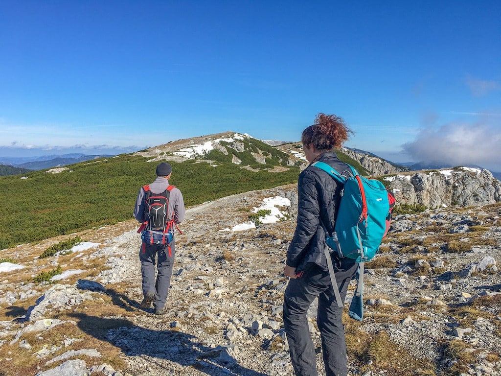
The Rax mountain is known for its diverse landscapes, including rocky cliffs, alpine meadows, and dense forests. It is a popular destination for hikers, climbers, and nature enthusiasts.
We start our hike on an easy forest road with amazing views of Rax Mountain. Soon, the forest road turns into a narrow, shady, and steep trail. From the start, the hiking path runs through a forest, but after gaining some height, we will enjoy stunning views of the valleys. The higher we climb, the more impressive the panoramas will be. In the end, the hiking trail is very rocky. We reach the plateau of the Rax mountain after approx. 2,5 hours, having mastered 861 meters of elevation difference.
We take a well-deserved break at the cabin (1.640 m), enjoying breathtaking views into the valleys, the neighboring Schneeberg (snow mountain) peak, and the vast plateau with its alpine flora. You can try traditional desserts like yeast dumplings coated with melted butter, sugar, poppy seed, and other local delicacies.
Below the cabin, we’ll find an Alpine garden with rare wildflowers and plants. After the break, we explore the other side of the plateau to enjoy another fantastic view of the so-called Hoellental (“Hell Valley”). Finally, we start our way back on a pretty steep downhill path. Hiking the Viennese Alps will be something to remember!
Difficulty Hike the Viennese Alps
I consider the Hike the Viennese Alps tour a demanding activity. Please only sign up if you are in very good physical shape, have no fear of heights, and are sure-footed. Walking time: approx. 4 hours 15 minutes. Elevation gain/loss: 861 m Lowest point: 779 m Highest point: 1.640 m Distance: approx. 9 km
Itinerary
- 07.00 departure U3 Kendlerstrasse (exit Opfermanngasse/in front of FitInn fitness club)
- 08.30 start of the hike
- 12.00 lunch break (approx.)
- 15.30 departure
- 17.00 arrival U3 Kendlerstrasse
Meeting point
We meet at U3 Kendlerstrasse/exit Opfermanngasse for carpooling (complimentary ride). Take the U3 subway (orange line) and get off at the stop Kendlerstrasse. Follow the EXIT Opfermanngasse and use the first gate. Wait in front of the FitInn fitness club. Alternatively, meet me directly at Rax.
What’s included
The price includes the guided hike by a certified guide. Enjoy personalized attention in a small group: we adapt to your speed and wishes. Complimentary ride from Kendlerstrasse or meet directly at Rax. Not included are transfers, food & drink, entry fees, and personal insurance including mountain rescue and equipment.
Private Van option:
Hotel pick-up/drop-off within districts 1-9 included. 7 people max. On request, please send an email for date & price options.
Please note
- Carefully read and follow the recommendations under tips & tricks
- Please bring along some money in cash, the cabin does not accept card payment
- Hiking boots with good traction are mandatory for participation in this hike
- If you have any questions or concerns, contact me or take a look at our FAQ.
- Thank you for being on time! Guests who arrive later than 15 minutes after scheduled departure are considered a no-show and not entitled to any refund.